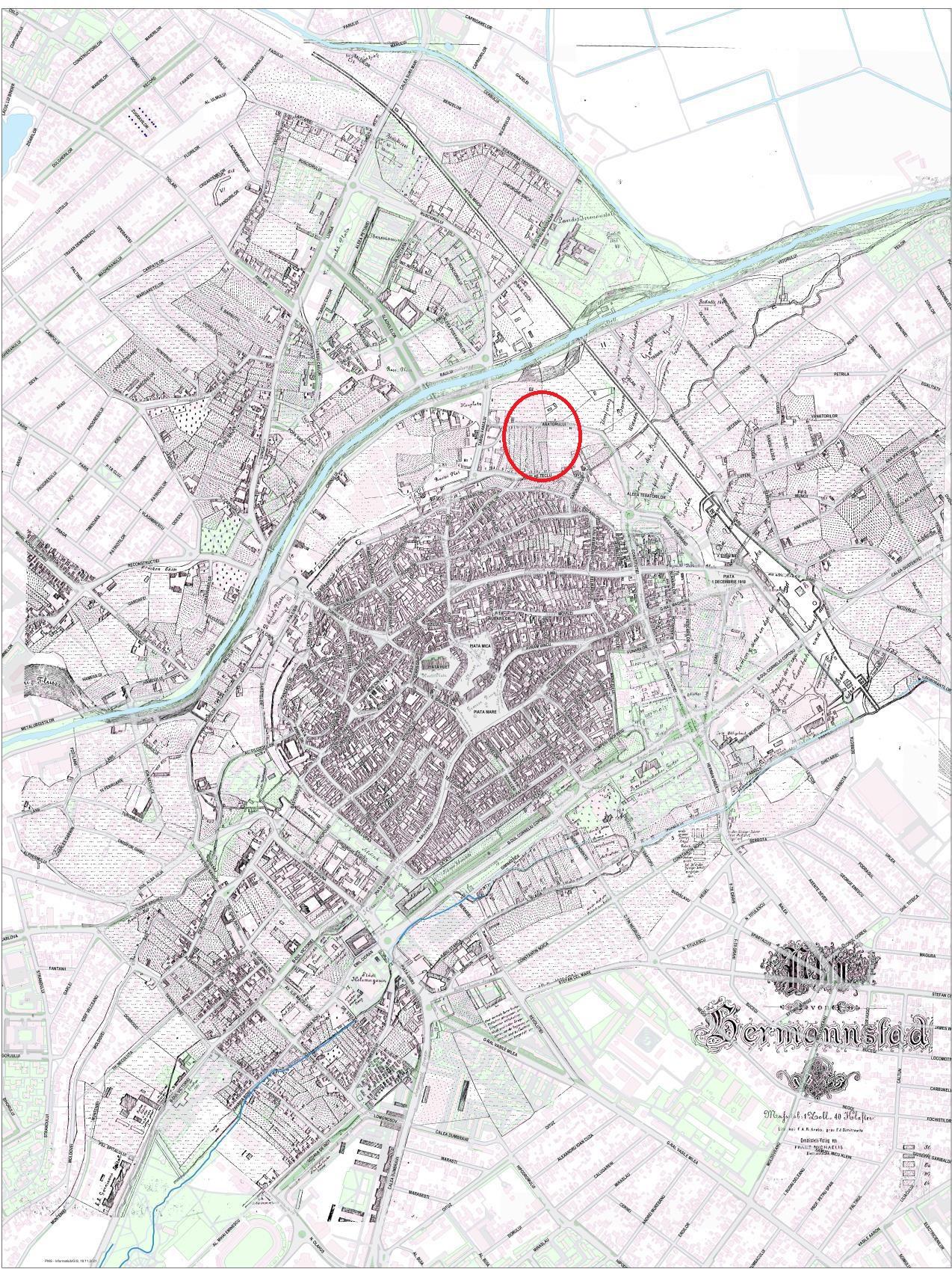



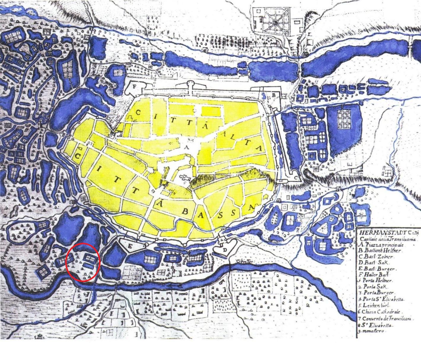
The city of Sibiu was founded in the mid-12th century by Saxon settlers from the western Rhine region. It was first documented in 1191 under the name Cibinium. After the great Mongol invasion of 1241, the city was gradually fortified, reaching the expansion indicated on the 1699 map (Map No. 1). Analyzing this map, we observe several roads surrounding the fortress and connecting to the city gates.
Access to Poarta Ocnei – the most important road in the city – was connected to Piața 1 Decembrie 1918 through parcels along the northern alignment of Regele Ferdinand Street, emerging at the roundabout linking Abatorului, Constituției, Nicolae Teclu, and Regele Ferdinand Streets.
On the current site of the Amylon real estate project, there were several lands belonging to Sibiu’s leading families. These lands were initially outside the city walls and were later parceled to accommodate new urban developments. Thus, the area encompassing Abatorului (up to Libertatea Complex), Călan, Traian, Moreni, and Viitorului Streets belonged to the Brukenthal family. The land between Regele Ferdinand, Abatorului, Moara de Scoarță, Lupeni Streets, and Piața 1 Decembrie 1918 belonged to Baron Rosenfeld.
In addition to fortification walls, another obstacle for invaders was the marshes formed along the banks of the Cibin River, which surrounded the city. With Transylvania’s integration into the Habsburg Empire and the designation of Sibiu as the capital of the Grand Principality, the military significance of these marshes diminished considerably. Medieval references indicate that these marshes also had an economic purpose – during peacetime, they were used as vegetable gardens, fish ponds, orchards, and for other agricultural activities. Travelers in the 16th and 17th centuries remarked upon these „wonderful gardens” (Maps No. 2 and 3).
From the mid-18th century until the end of the century, the marshes were gradually drained to make way for new urban developments and residential areas. The land ownership system was mixed and highly diverse. The resulting lands belonged to the community, represented by the Magistrate; places of worship and Sibiu’s parish; Sibiu’s patricians; neighborhood associations; and especially the guilds. The guilds played a crucial role since they directly administered the largest lakes in the area.
The Modern Era:
Sibiu’s Abattoir was inaugurated on December 1, 1888, marking a significant moment in the city’s industrial infrastructure development. Located on the current Abatorului Street, it served the local community for nearly a century. Over time, the area around the abattoir became an important industrial center.
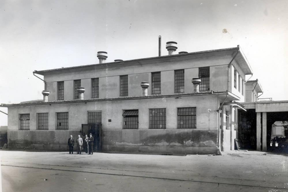
Source: https://sibiucity.ro/ro/foto2/vechiul-abator
The Interwar Period:
In 1920, the Amylon starch factory (commonly known as „scrobeală”) was established on Abatorului Street, under its german name Stärkefabrik. This reflected the influence of Sibiu’s Saxon population, which played a vital role in the city’s industrial development. Amylon became one of Romania’s oldest factories specializing in starch production and potato-based derivatives.
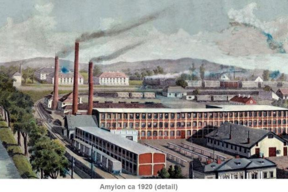
Source: https://wikimapia.org/41225551/Former-Amylon-factory
The Communist Era:
After the nationalization of 1948, Amylon became a state-owned enterprise, integrated into the centrally planned socialist economy. In 1957, it was merged into the Sibiu Food Industry Combine.
The Post-Communist Era (After 1989):
In 1996, following the fall of the communist regime, Amylon underwent privatization and restructuring, becoming a majority private capital company. In 2002, it was acquired by Moara Cibin S.A., part of the Boromir Group, one of Romania’s largest producers in the bakery and confectionery industry. Thus, Amylon Sibiu transitioned from a communist starch factory to a modern food production company that continued its long-standing tradition.
The Present:
Amylon – A New Standard for Urban Living in Sibiu
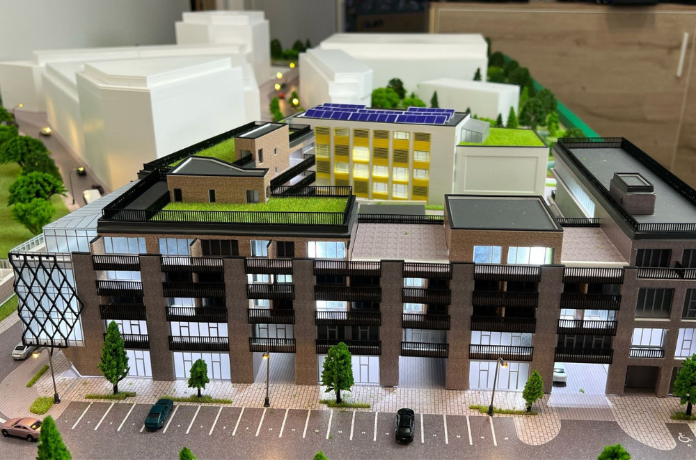
In a city undergoing continuous transformation, urban space is being redefined to meet contemporary needs. On the former Amylon factory site in Sibiu, an ambitious project is taking shape: a modern, sustainable district seamlessly integrated into the city’s evolving landscape.
In 2016, the land was purchased by investor Paul Koenig, representing Baumaschienenservice SRL, with a vision to transform the area into a landmark urban development. Keeping the Amylon name, the project respects the site’s identity while offering a fresh perspective on living in Sibiu.
Construction began in December 2024 and will be completed in phases over eight years. Amylon will be a multifunctional district, designed to provide a balance between living, working, and leisure.
The Amylon District will unfold like a miniature city, integrating various functions to serve the needs of a thriving community. Elegant apartments, modern offices, commercial spaces, schools, and kindergartens will be complemented by dedicated areas for relaxation and socialization: fine dining restaurants, sports halls, spas, playgrounds, and vast green spaces. A peaceful lake will reflect the beauty of the surroundings, while romantic alleys, public squares, and an open-air amphitheater will complete the charm of this new neighborhood.
A new urban landmark for Sibiu, Amylon – where history continues!

Map no. 1.- map of Sibiu made by Giovanni Morando Visconti in 1699.
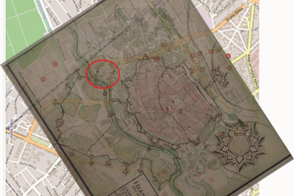
Map no. 2.- georeferencing of the map of Sibiu made by Johann Georg Maximilian von Furstenhoff between 1735-1739.
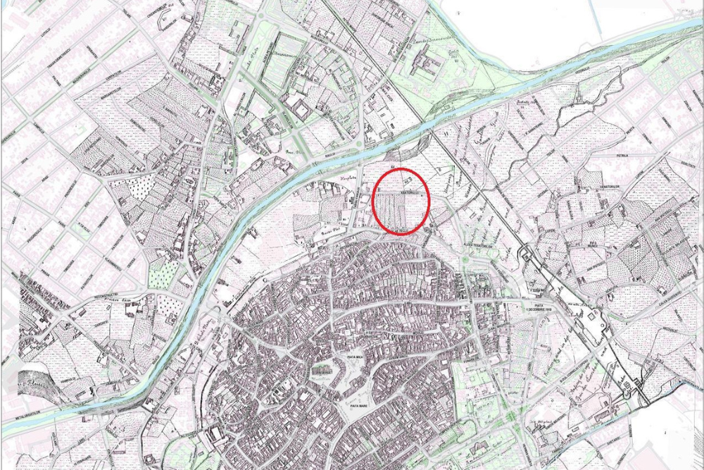
Map no. 3. -georeferencing of the map of Sibiu made by Krabs and Dimitriwits in 1875.